
OPEN
ALL LANES CLEAR
Last updated at: NOV 15, 2026, 5:56 AM PST · Caltrans
Live Caltrans status, chain controls, and cameras for the I-80 drive between Sacramento and Reno.

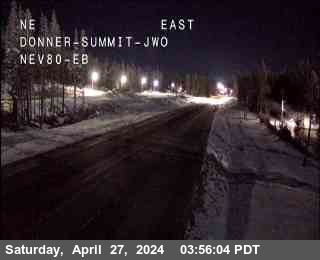
Hwy 80 at Donner Summit
Soda Springs|landscape7,221 ft

Hwy 80 at Castle Peak
Soda Springs|landscape7,165 ft

Hwy 80 at Soda Springs EB
Soda Springs|landscape6,692 ft
Hwy 80 at Donner Summit
Soda Springs · 7,221 ft
1 of 21
Applegate
Applegate · 2,020 ft
Applegate - End of Control
Applegate · 2,040 ft
Colfax
Colfax · 2,421 ft
Gold Run
Gold Run · 3,188 ft
Alta
Alta · 3,379 ft
Baxter
Alta · 3,897 ft
Drum
Alta · 4,333 ft
Drum (Whitmore)
Alta · 4,599 ft
Whitmore
Alta · 4,770 ft
Check Current Highway Conditions
This highway information is the latest reported as of Sunday, November 15th, 2026 at 05:56 AM.
IN THE SAN FRANCISCO BAY AREA - SOLANO CO
No traffic restrictions are reported for this area.
IN THE NORTHERN CALIFORNIA AREA & SIERRA NEVADA
No traffic restrictions are reported for this area.
BUSINESS 80 - CAPITAL CITY FREEWAY
No traffic restrictions are reported for this area.
Incoming storms, road conditions, and resort news, straight to your inbox.
Driving the other way? Reno to Sacramento I-80 road conditions carries the same live status, chain controls, and cameras for the westbound drive.
The summit stretch has its own page: Donner Pass road conditions, with the pass status, its chain controls, and its cameras.
Check the live chain controls for every Sierra pass before you leave, not just Donner.
Read the Donner Pass chain guide for what R-0, R-1, R-2, and R-3 mean, and what to carry in the car.
Watch the I-80 cameras live, alongside every other camera on the corridor.
Check Donner Summit weather before you leave, with current conditions and the seven day forecast at the top of the pass.
The drive between Sacramento and Reno on I-80 is about 180 miles, and almost all of its winter trouble is concentrated in one stretch: the climb from Colfax over Donner Summit and down to Truckee. The status above is the live Caltrans picture for the California stretch of the route, with the chain control points and cameras for the drive below it. The valleys at either end are usually the easy part; check the summit before you commit to the drive.
Is I-80 open between Sacramento and Reno right now?
Right now, I-80 between Sacramento and Reno is open with no chain controls posted (Caltrans, last updated NOV 15, 2026, 5:56 AM PST). That read covers the California stretch of the drive, Sacramento to the Nevada state line over Donner Summit, and the status block at the top of this page shows the same read.
How long does it take to drive from Sacramento to Reno on I-80?
The drive is about 180 miles and takes roughly three hours in clear, dry conditions. In a storm, chain controls over Donner Summit can add hours, and Caltrans can close the road outright. The live status at the top of this page, not the clock, decides when to leave.
Do I need chains driving from Sacramento to Reno today?
Right now, I-80 between Sacramento and Reno is open with no chain controls posted (Caltrans, last updated NOV 15, 2026, 5:56 AM PST). Chain controls on this route are posted over Donner Summit, between Kingvale and Truckee. If the posted level is R-1, R-2, or R-3, follow that level. See the chain guide for what each level means.