
OPEN
ALL LANES CLEAR
Last updated at: NOV 15, 2026, 5:56 AM PST · Caltrans
The deep page for the summit itself: the live pass verdict with its Caltrans timestamp, the chain control ladder from Kingvale to Truckee, and the Donner Summit cameras.

Hwy 80 at Donner Summit
Soda Springs|landscape7,221 ft

Hwy 80 at Castle Peak
Soda Springs|landscape7,165 ft

Hwy 80 at Soda Springs EB
Soda Springs|landscape6,692 ft
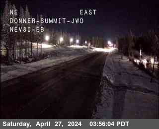
Hwy 80 at Donner Summit
Soda Springs · 7,221 ft
1 of 7
Cisco Grove
Soda Springs · 5,649 ft
Rainbow
Soda Springs · 5,734 ft
Kingvale
Soda Springs · 6,069 ft
Castle Peak, (@ DRA Holding only)
Norden · 7,247 ft
DLI (Donner Lake Interchange)
Norden · 6,361 ft
DLI (Donner Lake Interchange)
Truckee · 6,404 ft
Truckee
Truckee · 5,905 ft
Overland Trail - OTL Truck Screens
Truckee · 5,820 ft
Boca
Truckee · 5,531 ft
Check Current Highway Conditions
This highway information is the latest reported as of Sunday, November 15th, 2026 at 05:56 AM.
IN THE SAN FRANCISCO BAY AREA - SOLANO CO
No traffic restrictions are reported for this area.
IN THE NORTHERN CALIFORNIA AREA & SIERRA NEVADA
No traffic restrictions are reported for this area.
BUSINESS 80 - CAPITAL CITY FREEWAY
No traffic restrictions are reported for this area.
Incoming storms, road conditions, and resort news, straight to your inbox.
Check the live chain controls for every Sierra pass before you leave, not just Donner.
Read the Donner Pass chain guide for what R-0, R-1, R-2, and R-3 mean, and what to carry in the car.
Watch the Donner Pass cameras live, alongside every other camera on the corridor.
For the corridor wide answer, every mile of I-80 from the Bay Area to Reno, start at the I-80 road conditions homepage.
For the forecast right at the top of the pass, see Donner Summit weather, with current conditions and the seven day outlook at the summit.
Heading the other way, the Reno to Sacramento road conditions page covers the full drive west with the same live status.
Live road conditions for I-80 over Donner Pass, from Kingvale and Soda Springs, over Donner Summit, and down past Donner Lake to Truckee. The status above is the live Caltrans picture for the pass, with the chain controls, cameras, and advisories for the Donner segment below it.
Donner Pass is where Interstate 80 crosses the Sierra Nevada crest, the high point of the whole run between Sacramento and Reno. The summit sits above 7,000 feet, between Kingvale on the west climb and Truckee on the east side, with Soda Springs and Donner Lake tucked under the crest. Everything on this page is about that one stretch: the few miles where Sierra weather decides whether the corridor moves or stops.
That geography is why the summit gets a page of its own. Sacramento can be dry and Reno clear while the top of the pass is in falling snow and chain controls, because the crest catches weather the valleys never see. The Donner Summit camera, at about 7,221 feet, reads the crest itself, and the chain checkpoints below it read the climb one stage at a time. For the corridor wide picture, all of I-80 from the Bay Area to Lake Tahoe and Reno, the I-80 road conditions homepage carries the full answer. This page goes deep on the top.
Caltrans does not control the Donner stretch from one booth. The checkpoints form a ladder up both sides of the crest, and the live list on this page shows every rung with its level: Cisco Grove at 5,649 feet and Rainbow at 5,734 feet, low on the west climb; Kingvale at 6,069 feet; Soda Springs on the upper climb; Castle Peak at 7,247 feet, the holding point at the crest; the Donner Lake Interchange at about 6,400 feet on the east descent; and Truckee at 5,905 feet.
Kingvale is the name most eastbound drivers know. It is a regular chain control checkpoint west of the summit, close to where eastbound traffic slows, chains up, and gets screened before the final climb. Westbound, the screening happens on the Truckee side, and the descent runs past Donner Lake and the Castle Peak point before Kingvale. Whichever way you are driving, the level that applies to you is the one posted at the checkpoint you are approaching, so read the whole ladder, not just the top.
The levels themselves are California law, and the chain guide on this site explains them in full. In short: R-1 requires chains or snow tires on the drive axle, with chains carried in the vehicle. R-2 requires chains on everything except four wheel drive with snow tires on all four wheels, which must still carry chains. R-3 requires chains on all vehicles, no exceptions, or the road is closed. Carry chains on every winter crossing, whatever the forecast says: controls can be posted while you are on the climb.
The Caltrans cameras on the Donner stretch are all on this page, and the webcams section leads with the three that matter most: Donner Summit at the crest, Castle Peak just west of it at 7,165 feet, and Soda Springs EB at 6,692 feet on the climb. The camera tour below them walks the rest, including Kingvale and Donner Lake, in driving order.
Read them in order and you can see the shape of a storm before you leave: whether snow is sticking at Kingvale, whether the crest is blowing clear or white, and whether the east side at Donner Lake is already drying out. Each camera also has its own page, starting with the Donner Summit camera and the Castle Peak camera, with its facts, what the view shows, and the cameras either side of it.
The forecast that matters here is not the valley forecast; it is the summit own. The Donner Summit weather page carries current conditions and the seven day forecast for the top of the pass, with an hourly view. Read it together with the live status at the top of this page: the forecast tells you what is coming over the crest, and the status tells you what Caltrans already has on the road. When a storm is on the way, the storm alerts signup on this page puts the warning in your inbox before it reaches the pass.
On a clear day the summit is a non event: up from Kingvale, over the crest, and down to Truckee in one steady climb and descent. The days that cost drivers hours are the transition days, when controls go up or come down around them. A checkpoint queue forms behind whichever point is screening, and the climb that runs free at speed turns into a line of cars and trucks at chain speed, all doing the same slow work over the top.
The working rules are simple. Check this page before you leave, not at the on ramp. If controls are posted and you are not in a hurry, waiting for the level to drop is often faster than joining the queue at its worst. If you go, carry chains and the patience to fit them, and check the status again at the last town stop, because the level at Kingvale can change while you are driving to it.
When the summit closes, it closes to everyone, and there is no short way around it. The through alternatives are the other Sierra crossings: south to US-50 over Echo Summit, by way of South Lake Tahoe and back up SR-89 or SR-267 to Truckee, or around the east side on US-395. Each is a long way around, and in the same storm each runs under its own chain controls, which this site tracks on their own pages.
That is why experienced Donner drivers usually wait. A closure ends when crews have the road cleared and the storm eases, and the live status at the top of this page, with its Caltrans timestamp, is the first word that the pass has reopened. Sit it out in Truckee or down the hill, keep the status open, and go when the verdict changes.
Is Donner Pass open?
Right now, I-80 over Donner Pass is open with no chain controls posted (Caltrans, last updated NOV 15, 2026, 5:56 AM PST). Donner Pass is the summit of I-80 between Soda Springs and Truckee, so that sentence is the pass status: open, under chain controls, or closed. The verdict block at the top of this page shows the same read.
Do I need chains on Donner Pass today?
Right now, I-80 over Donner Pass is open with no chain controls posted (Caltrans, last updated NOV 15, 2026, 5:56 AM PST). If the posted level is R-1, R-2, or R-3 at Kingvale, Castle Peak, Donner Lake, or Truckee, follow that level. The live chain controls on this page show the level at each checkpoint, and the chain guide explains what each level means.
Where are the chain control points on Donner Pass?
The Donner stretch runs a ladder of checkpoints up both sides of the crest: Cisco Grove and Rainbow low on the west climb, Kingvale at 6,069 feet, Castle Peak at 7,247 feet at the crest, the Donner Lake Interchange on the east descent, and Truckee at 5,905 feet. The live chain controls on this page show the level at each one right now.
What is the elevation of Donner Summit?
The summit sits above 7,000 feet between Kingvale and Truckee. The Donner Summit camera reads about 7,221 feet, and the Castle Peak checkpoint at the crest reads 7,247 feet. Sacramento and Reno can both be clear while the summit is in snow, which is why this page reads the top, not the valleys.
What do R-1, R-2, and R-3 mean on Donner Pass?
R-1 means chains or snow tires on the drive axle, and you must carry chains in the vehicle. R-2 means chains on all vehicles except four wheel drive with snow tires on all four wheels, and four wheel drive must still carry chains. R-3 means chains on all vehicles, no exceptions, or the road is closed. The chain guide explains the law in full; the live chain controls on this page show the level posted now.
Do I need chains with four wheel drive on Donner Pass?
At R-2, four wheel drive with snow tires on all four wheels may drive without fitting chains, but you must still carry them. At R-3 there are no exceptions. Check the live chain controls on this page for the level posted now, and carry chains on every winter crossing.
Which Donner Pass camera should I check?
Start with the Donner Summit camera, at about 7,221 feet at the crest: it shows the stretch where chain controls and closures are decided. Then work down: Castle Peak just west of the crest, Soda Springs EB on the climb, and Donner Lake on the east descent. All of them are live in the webcams section of this page, and each has its own camera page.
What is the weather at Donner Summit right now?
The summit has its own weather page: Donner Summit weather carries the current conditions and the seven day forecast for the top of the pass, with an hourly view. Read it with the live road status at the top of this page: the forecast says what is coming, the status says what Caltrans has on the road now.
When do chain controls go up on Donner Pass?
When snow and ice reach the road at the control points. Caltrans posts the level at the checkpoints listed on this page as conditions change, and lifts it when the road clears; there is no fixed schedule, and the level at your checkpoint can change while you are driving to it. Check the live chain controls before you leave, and again at the last town stop.
If Donner Pass closes, what is the detour?
There is no short way around. The through alternatives are the other Sierra crossings: US-50 over Echo Summit by way of South Lake Tahoe, then SR-89 or SR-267 back to Truckee, or around the east side on US-395. Each is a long way around and runs under its own chain controls in the same storm. When the summit closes, waiting for the live status at the top of this page to change usually beats detouring.
How long does a Donner Pass closure last?
There is no fixed time. A closure lasts while crews clear the road and the storm eases, and the live status at the top of this page, with its Caltrans timestamp, is the first word that the pass has reopened. Check it before you leave, and keep it open while you wait.
Is Donner Pass the same as Donner Summit?
On I-80, yes: the two names cover the same crossing. Donner Pass is the pass, and Donner Summit is its crest, where the highway tops out above 7,000 feet between Soda Springs and Donner Lake. This page covers the summit stretch in depth; the homepage carries the corridor wide I-80 answer.