
OPEN
ALL LANES CLEAR
Last updated at: NOV 15, 2026, 5:56 AM PST · Caltrans
Current conditions, the forecast, and the live road picture for Donner Summit on I-80, Kingvale to Truckee.

Hwy 80 at Donner Summit
Soda Springs|landscape7,221 ft

Hwy 80 at Castle Peak
Soda Springs|landscape7,165 ft

Hwy 80 at Soda Springs EB
Soda Springs|landscape6,692 ft
Hwy 80 at Donner Summit
Soda Springs · 7,221 ft
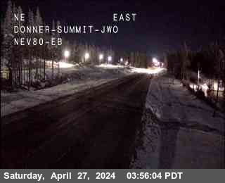
1 of 7
Cisco Grove
Soda Springs · 5,649 ft
Rainbow
Soda Springs · 5,734 ft
Kingvale
Soda Springs · 6,069 ft
Castle Peak, (@ DRA Holding only)
Norden · 7,247 ft
DLI (Donner Lake Interchange)
Norden · 6,361 ft
DLI (Donner Lake Interchange)
Truckee · 6,404 ft
Truckee
Truckee · 5,905 ft
Overland Trail - OTL Truck Screens
Truckee · 5,820 ft
Boca
Truckee · 5,531 ft
Check Current Highway Conditions
This highway information is the latest reported as of Sunday, November 15th, 2026 at 05:56 AM.
IN THE SAN FRANCISCO BAY AREA - SOLANO CO
No traffic restrictions are reported for this area.
IN THE NORTHERN CALIFORNIA AREA & SIERRA NEVADA
No traffic restrictions are reported for this area.
BUSINESS 80 - CAPITAL CITY FREEWAY
No traffic restrictions are reported for this area.
Incoming storms, road conditions, and resort news, straight to your inbox.
For the full road picture at the summit, see Donner Pass road conditions, with the live status, chain controls, and cameras for the pass.
Check the live chain controls for every Sierra pass before you leave, not just Donner.
Read the Donner Pass chain guide for what R-0, R-1, R-2, and R-3 mean, and what to carry in the car.
For the whole route, Sacramento to Reno, see the full I-80 road conditions page.
Heading down the west side, the Reno to Sacramento road conditions page covers the whole drive with the same live status.
Weather at Donner Summit decides what the drive over I-80 looks like. The summit sits above 7,000 feet between Kingvale and Truckee, so a clear day in Sacramento or Reno can still mean snow, wind, and chain controls at the top. The live weather above and the road status with its Caltrans timestamp, the summit cameras, and the chain controls below it give you the whole picture before you leave.
What is the weather at Donner Summit right now?
The live weather section at the top of this page shows the current conditions for the Donner Summit area, and the road status above it carries its Caltrans timestamp. Check the two together: the weather says what is happening in the sky, the status says what Caltrans has on the road right now.
Is it snowing at Donner Summit?
Look at the live Donner Summit cameras on this page and the current conditions in the weather section. If snow is falling at the summit, the cameras show it as it happens, and any chain controls Caltrans posts appear in the chain controls section below.
What is the Donner Summit forecast for this week?
The weather section at the top of this page carries the seven day forecast for the summit area, with an hourly view. In winter, pair it with the storm alerts signup on this page, so a forecast storm reaches you before it reaches the pass.