
OPEN
ALL LANES CLEAR
Right now, the Reno to Truckee route is open with no chain controls posted (Caltrans, last updated NOV 21, 2026, 3:41 AM PST).
Last updated at: NOV 21, 2026, 3:41 AM PST · Caltrans
via I-80: Donner Summit
One honest limit: the chain checkpoints on this page run the whole drive on the Caltrans feed, state line included. What is not folded in is Nevada 511's own reporting for the Nevada miles, its incidents and wind advisories west of the state line. For those, Nevada 511 is the read.
I-80
All 6 cameras →
Hwy 80 at 267
Truckee|landscape5,928 ft

Hwy 80 at Old Ag Sta
Truckee|landscape5,905 ft

Hwy 80 at Hwy 89
Truckee|landscape5,898 ft

Hwy 80 at Truckee Scales
Truckee|landscape5,826 ft

Hwy 80 at Truckee Scales WB
Truckee|landscape5,820 ft

Hwy 80 at Floriston
Truckee|landscape5,291 ft
I-80
Truckee
Truckee · 5,905 ft
Overland Trail - OTL Truck Screens
Truckee · 5,820 ft
Boca
Truckee · 5,531 ft
Floriston On-ramp
Floriston · 5,387 ft
CA / NV Stateline- Gold Ranch (End of Control)
Verdi · 5,006 ft
CA / NV Stateline - Gold Ranch
Verdi · 5,019 ft
Mogul
Reno · 4,724 ft
I-80
Donner SummitThis highway information is the latest reported as of Saturday, November 21st, 2026 at 03:25 AM.
IN THE SAN FRANCISCO BAY AREA - SOLANO CO
No traffic restrictions are reported for this area.
IN THE NORTHERN CALIFORNIA AREA & SIERRA NEVADA
No traffic restrictions are reported for this area. All westbound trucks are required to stop at the brake check area 0.5 mi west of Nyack (Placer Co) - To reduced the risk of brake fires
BUSINESS 80 - CAPITAL CITY FREEWAY
No traffic restrictions are reported for this area.
Incoming storms, road conditions, and resort news, straight to your inbox.
Dots are chain-control checkpoints, they sit on the mountain grades, not the whole drive. Green = clear.
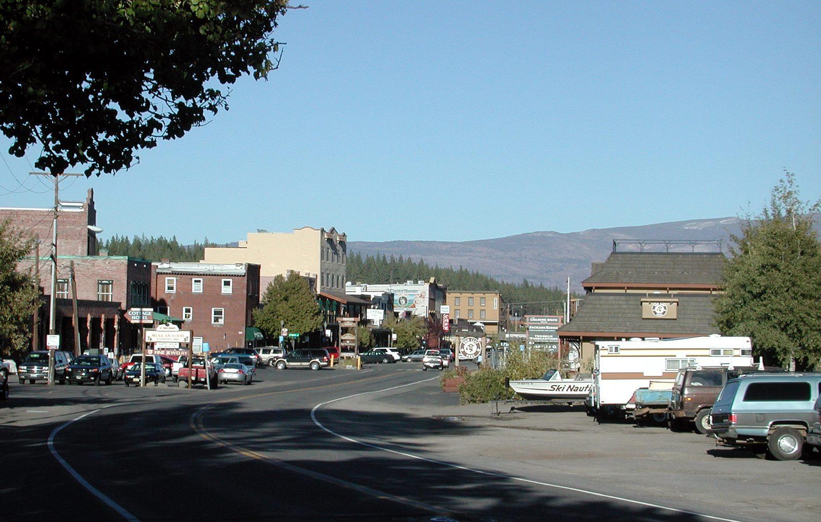
This is the short hop that joins Nevada to the Sierra: I-80 west out of Reno, across the state line, and up the Truckee River canyon to Truckee. About 35 miles, and about 40 minutes on a clear day. It is the reverse of the drive most people picture on I-80. Instead of climbing out of a valley into the mountains, it leaves a desert city at about 4,500 feet and climbs west, into a river canyon and up to a mountain town at about 5,900 feet, gaining altitude and winter the whole way. Reno drivers make it for skiing, for Truckee's restaurants and shops, and as the first half of the crossing to Sacramento and the Bay Area.
The status at the top of this page is the live read for this stretch: the I-80 checkpoints from Mogul, at Reno's west edge, across the state line at Gold Ranch, and up the canyon through Floriston and Boca to Truckee. The chain checkpoints run the whole drive on the Caltrans feed, Nevada end included. What the status does not fold in is Nevada 511's own incident and wind reporting for the Nevada miles, and the note at the top of the page says so plainly.
One road, two halves. The first is Nevada freeway: Reno's west edge, Mogul, and Verdi, fast and open, climbing gently to the state line at Gold Ranch at about 5,010 feet. The second is the Truckee River canyon: about 20 miles of freeway cut into the hillside above the river, through Floriston at about 5,400 feet and Boca at 5,531, to Truckee at about 5,900. The halves have different weather, different hazards, and different tempers, and the canyon half is the one that decides this drive in winter.
About timing, honestly. Forty minutes is the clear day number, and most of the year it holds. In winter the canyon writes its own schedule: a chain line at Boca or a spinout hold near Floriston turns 35 miles into two hours, and a full canyon closure turns it into a wait for the reopening, because there is no way around inside the canyon. The live status at the top of this page is the difference between knowing that at your front door and learning it at the closure gate.
I-80 leaves Reno past the Mogul checkpoint, at 4,724 feet, and runs west through Verdi, the last Nevada services on the route. The road is already climbing, gently, through the dry hills at the Sierra's edge. At Gold Ranch the state line checkpoint sits at about 5,010 feet, and the drive's character changes with the state: the hills close in, the river comes up to meet the road, and the desert falls behind. This half of the drive has its own winter hazard, and it is wind: the open stretch west of Reno is exposed, and high profile vehicles feel it first. Nevada 511 carries the wind advisories for these miles.
This half of the drive has a temperature trick worth knowing. Reno sits in a valley that pools cold air on still winter mornings, and the canyon, fed by the river and open to the Sierra's weather, can run warmer than the city at dawn, then colder by afternoon when the storm arrives. Do not read the canyon off a Reno thermometer in either direction. The checkpoints at Mogul and Gold Ranch bracket the leg, and the Floriston camera shows the canyon itself.
From the state line, I-80 follows the Truckee River upstream into California, and the canyon takes over. The road runs on a shelf above the river through Floriston, a tiny railroad community at about 5,400 feet, and past Boca, at 5,531 feet, where the Boca reservoir branch joins the river. It is a beautiful drive and a serious one: shaded by the canyon walls, cooled by the river, and prone to ice on its bridges and shadowed corners on mornings when Reno's streets are dry. The canyon's checkpoints, Floriston and Boca, are in this page's live list, and its camera, at Floriston, shows the road surface the checkpoints describe.
The canyon is a shared corridor. The transcontinental railroad runs the same slot above the river, on the far bank for much of the way, and Amtrak's California Zephyr passes through on its run between the Bay Area and Chicago. The river, the railroad, and the freeway are stacked into a canyon that has been the Sierra's eastern doorway for a very long time. It is also why a closure here is so complete: there is no frontage road and no side route inside the canyon. When it closes, it closes.
East of Boca the canyon opens, the road passes the Overland Trail truck screening point at 5,820 feet, and I-80 arrives in Truckee at about 5,900 feet. Truckee is where this drive ends and three others begin: west over Donner Summit toward Sacramento, south on SR-267 to the North Shore, and south on SR-89 down the river to Tahoe City. If your trip continues over the summit, understand that the chain line for that crossing posts here, at Truckee and the Donner Lake Interchange, and the homepage and the Sacramento to Truckee route page carry that read.
On this stretch, controls post in the canyon and at its ends. Boca and Floriston are the canyon points: when the snow line drops into the canyon, they post first. Truckee, at the top of the drive, posts with the summit system, and when Donner Summit controls are up, the westbound chain line starts at Truckee itself. The state line point at Gold Ranch rounds out the list. Reno's own weather is the trap on this drive: the city sits in the rain shadow, routinely dry and calm while the canyon, 20 miles west and 1,000 feet higher, is in falling snow. The chain guide explains what each level requires of your vehicle.
The return trip has its own pattern. Leaving Truckee for Reno in a storm, the summit system behind you is irrelevant, but the canyon points ahead are not: a control line can post at Boca or Floriston while Truckee's streets are merely wet. Reno bound drivers at night are the ones most often caught, because home feels close long before the canyon is behind them. Check the list from the Truckee side before you leave town, not from the Reno side when you get home.
Reno has everything, and Verdi, about 10 miles west, is the last Nevada stop with fuel and food. From Verdi there is nothing until Truckee, about 25 miles, and nothing at all inside the canyon. That gap is short on a clear day and long in a storm queue at Boca. Leave Reno with a full tank in winter, and treat Verdi as the last easy decision point: fuel, chains in the car, and the live check done, before the canyon commits you.
When I-80 closes in the Truckee River canyon, Reno and Truckee are effectively cut off from each other, and it is better to plan around that fact than around a map. The one real alternative is the lake route: the Mount Rose Highway, SR-431, from south Reno over Mount Rose Summit at 8,911 feet to Incline Village, then around the North Shore on SR-28 and up SR-267 to Truckee. It is more than twice the distance, it crosses a higher summit than Donner, and in the storm that closed the canyon it usually carries chain controls of its own. It is a detour of last resort, not a shortcut. For almost every driver, the right answer to a canyon closure is to wait in Reno or Truckee and watch the live status for the reopening.
Three checks, two minutes. First, the route status at the top of this page: the canyon checkpoints, Boca and Floriston, are the read that matters, not the Reno sky. Second, Nevada 511 for incidents and wind on the Nevada miles, the one part of this drive this page does not fold in. Third, chains in the car from November through April. Reno is a desert city, and its drivers are the ones most often surprised by a chain checkpoint 30 minutes from home, in a canyon that lives in a different climate.
Is I-80 from Reno to Truckee open?
Right now, the Reno to Truckee route is open with no chain controls posted (Caltrans, last updated NOV 21, 2026, 3:41 AM PST). That status is the I-80 read for the Reno to Truckee stretch: the checkpoints from Mogul at Reno's west edge, across the state line at Gold Ranch, up the Truckee River canyon through Floriston and Boca, to Truckee. It, not this answer, tells you if the drive is open, under chain controls, or closed right now.
Do I need chains from Reno to Truckee today?
Right now, the Reno to Truckee route is open with no chain controls posted (Caltrans, last updated NOV 21, 2026, 3:41 AM PST). On this stretch the checkpoints that govern are Truckee, Boca, and Floriston, with the state line point at Gold Ranch. If any shows R-1, R-2, or R-3, follow that level. See the chain guide for what each level means.
How far is Reno to Truckee, and how long does it take?
About 35 miles, all on I-80 west. In clear weather, about 40 minutes. It is a short drive that changes character fast: city freeway out of Reno, a river canyon for the middle half, and a climb of about 1,400 feet from Reno to Truckee at about 5,900 feet. Chain controls in the canyon, or a storm sitting on the state line, can double the time.
What is the drive from Reno to Truckee like?
I-80 leaves Reno past Mogul and Verdi, crosses the state line at Gold Ranch at about 5,010 feet, and enters the Truckee River canyon. The canyon half is the drive: two lanes each way cut into the hillside above the river, through Floriston at about 5,400 feet and Boca at 5,531, before the road opens out at Truckee. It is shaded, it follows cold water, and in winter it ices earlier and thaws later than either town at its ends.
Where do chain controls usually go on for this drive?
On this stretch, at Boca and Floriston in the canyon, and at Truckee itself. When Donner Summit controls are posted, the westbound chain line starts at Truckee and the Donner Lake Interchange, just past the end of this drive, so a Reno driver continuing over the summit meets it as they leave Truckee. The live checkpoint list on this page shows the posted points on the canyon stretch right now.
Does this page cover the Nevada part of the drive?
The chain checkpoints do: the Caltrans feed carries the state line point at Gold Ranch and the Mogul checkpoint at Reno's west edge, and both are in this page's live list. What is not folded in is Nevada 511's own reporting for the Nevada miles, its incidents and wind advisories. That is the one gap, it is named in the note at the top of this page, and Nevada 511 is the read for it.
Are there webcams between Reno and Truckee?
Yes. The webcams along the route section of this page carries the I-80 cameras in the canyon, including Floriston, and at the Truckee end of the drive. The canyon is where this trip is decided, and its cameras show the road surface the checkpoints only describe. If a camera image is dark or stale, the chain checkpoint list is the read to trust.
Can the canyon be icy when Reno is dry?
Yes, and it is the classic pattern on this drive. Reno sits in the desert rain shadow at about 4,500 feet, while the canyon runs higher, shaded, and alongside a cold river. Bridges near Floriston and Boca ice first, often on clear cold mornings when Reno's streets are merely wet or dry. The checkpoint list, not the Reno sky, is the read for this trip.
What if I-80 closes in the Truckee River canyon?
Reno and Truckee are split until it reopens. There is no side road through the canyon that serves as a winter detour, and the apparent alternatives, over the Mount Rose Highway to the North Shore and around the lake, are mountain drives with their own chain controls in the same storm. The practical choices are waiting in Reno or waiting in Truckee, and the live status tells you when the canyon reopens.
When is traffic worst between Reno and Truckee?
Weekend mornings westbound, when Reno heads for the Truckee side resorts, and Sunday afternoons eastbound coming home. Truck traffic is heavy on this stretch all week, and the Overland Trail truck screening point east of Truckee is part of this drive's checkpoint list. In storms, any chain posting at Boca slows the canyon to one careful line.
What is the Overland Trail checkpoint on this drive?
It is the truck screening point on I-80 east of Truckee, at 5,820 feet in the live list, where trucks are screened in chain season before the summit crossing. Passenger vehicles pass it without stopping, but its posted level is part of this page's read, because it sits on the Reno to Truckee drive and reflects the same canyon weather.
Do I need chains if I have all wheel drive?
Under R-2, all wheel drive and four wheel drive vehicles with snow tires on all four wheels are excepted from chaining up, but they must still carry chains in the vehicle. Under R-3 there are no exceptions. Reno drivers meet this rule at Truckee and in the canyon, so check the live level on this page before you leave and see the chain guide for the full rules.
Where do I check right before I leave Reno?
Here for the canyon and Truckee, and Nevada 511 for incidents on the Nevada miles. The route status at the top of this page combines this stretch's live checkpoints with a Caltrans timestamp. If your drive continues over Donner Summit, the homepage carries the full corridor, and the Sacramento to Truckee page covers the west side climb.