
OPEN
ALL LANES CLEAR
Last updated at: NOV 20, 2026, 11:33 AM PST · Caltrans

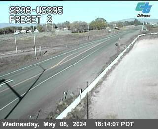
SR36-US395
Susanville|landscape4,180 ft

Janesville
Janesville|landscape4,165 ft

Doyle
Doyle|landscape4,300 ft
SR36-US395
Susanville · 4,180 ft
1 of 4
Junction SR 36
Susanville · 4,160 ft
TOP OF BASS HILL (4,358 ft
Janesville · 4,370 ft
9 miles south of Junction SR 36
Janesville · 4,130 ft
1 mile north of Doyle
Doyle · 4,320 ft
10 miles north of Junction SR 70
Doyle · 4,488 ft
9 miles north of Junction SR 70
Chilcoot · 4,488 ft
Junction SR 70 at Hallelujah Junction
Chilcoot · 5,045 ft
Nevada Border
Chilcoot · 5,104 ft
Check Current Highway Conditions
This highway information is the latest reported as of Friday, November 20th, 2026 at 11:33 AM.
IN THE SOUTHERN CALIFORNIA AREA
No traffic restrictions are reported for this area.
IN THE CENTRAL CALIFORNIA AREA
Chains or snow tires are required from 20 mi north of Bishop to 17 mi south of the Nevada State Line (Mono Co) - Large trucks with single-axle-drive towing two trailers are prohibited in chain control areas A high wind advisory is in effect from Pearsonville to Lone Pine (Inyo Co) - Travel is not recommended for campers, trailers, or permit loads
IN THE NORTHERN CALIFORNIA AREA
No traffic restrictions are reported for this area.
Incoming storms, road conditions, and resort news, straight to your inbox.
Coming from Redding on CA-44? See redding to reno road conditions on its own page: the live route status for the whole trip from Redding, with the Eskimo Hill and Bogard checkpoints on CA-44 and this highway's run to the state line.