
CLOSED
ROAD CLOSED: DO NOT TRAVEL
Last updated at: NOV 15, 2026, 5:56 AM PST · Caltrans
Live Caltrans status, chain controls, and cameras for SR-89 past Emerald Bay, Tahoe City to South Lake Tahoe.

Hwy 89 at Fairway Dr
Tahoe City|landscape6,286 ft

Hwy 89 at Granlibakken
Tahoe City|landscape6,256 ft

Hwy 89 at Rampart
Olympic Valley|landscape6,250 ft
Hwy 89 at Fairway Dr
Tahoe City · 6,286 ft
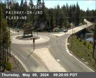
1 of 7
Olympic Valley
Tahoe City · 6,131 ft
Tahoe City
Tahoe City · 6,243 ft
Tahoma - Eldo / Placer Co Line
Tahoma · 6,305 ft
Tahoma ( Co line / Sugar Pine )
Tahoma · 6,332 ft
Harper's Grade
Tahoma · 6,292 ft
Bliss State Park
Tahoma · 6,840 ft
Emerald Bay
South Lake Tahoe · 6,624 ft
Ebrights
South Lake Tahoe · 6,289 ft
Check Current Highway Conditions
This highway information is the latest reported as of Sunday, November 15th, 2026 at 05:56 AM.
IN THE CENTRAL CALIFORNIA AREA & SIERRA NEVADA
Is closed from the Jct of US 395 (Mono Co) to the Jct of SR 4 /Monitor Pass/ (Alpine Co) - Due to snow - Motorists are advised to use an alternate route
IN THE NORTHERN CALIFORNIA AREA
No traffic restrictions are reported for this area.
Incoming storms, road conditions, and resort news, straight to your inbox.
For the whole highway, including Luther Pass, see the full SR-89 road conditions page.
Continuing south past the bay? Check Luther Pass weather for conditions at the top of the other SR-89 climb.
Check the live chain controls for every Sierra pass before you leave.
Read the chain guide for what R-0, R-1, R-2, and R-3 mean, and what to carry in the car.
The SR-89 drive past Emerald Bay is the most scenic stretch of road at Lake Tahoe, and one of the first to close when snow slides or ice coats the switchbacks above the bay. The status above is the live Caltrans picture for SR-89, with the West Shore chain controls, cameras, and advisories below it, so you know before you commit to the drive from Tahoe City.
Is Emerald Bay open?
Right now, SR-89 past Emerald Bay is closed, with controls posted at MONITOR PASS (Caltrans, last updated NOV 15, 2026, 5:56 AM PST). The road past Emerald Bay is SR-89 along the West Shore.
Do I need chains to drive to Emerald Bay today?
Right now, SR-89 past Emerald Bay is closed, with controls posted at MONITOR PASS (Caltrans, last updated NOV 15, 2026, 5:56 AM PST). If the live page shows R-1, R-2, or R-3 at Emerald Bay, Bliss State Park, or anywhere on the West Shore, follow that level. See the chain guide for what each level means.
Where are the chain control points near Emerald Bay?
On SR-89, Caltrans runs chain control points through the West Shore corridor, including Tahoe City, Tahoma, Bliss State Park, and Emerald Bay itself. The live chain controls on this page show which points are active right now and the level at each one.